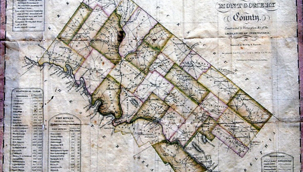
An 1830 Montgomery County map has been acquired by the Schwenkfelder Library and Heritage Center for display in Pennsburg this fall. Joe Zlomek unrolled this story at The Sanatoga Post.
The document is estimated to be one of the earliest printed maps of the county.
The Schwenkfelder Library acquired it at auction as another element in its mission to preserve local history.
Schwenkfelder’s Executive Director Beth Twiss Houting provided insight on its details: The artwork depicts vintage “roads, mills, churches, post offices, quarries, and manufacturers,” she wrote in an email.
The snapshot of the past is as interesting for what it contains as it is for what is absent. Many Montgomery County locales that now operate as separate communities were part of larger geographies then.
“Upper Hanover Township in 1830 was still completely intact, since Pennsburg, East Greenville, and Red Hill were not boroughs yet,” Houting said.
More on the vintage map and its arrival at the Schwenkfelder Library and Heritage Center is at The Sanatoga Post.