The Pennsylvania Department of Health has released an interactive map containing ZIP Code-level information about cases of the new strain of the coronavirus, according to a staff report from FOX 56.
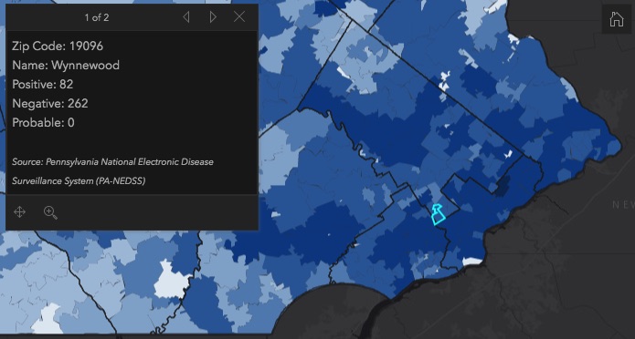
The map shows the number of confirmed cases of COVID-19 and the number of negative virus tests at the ZIP Code-level. The county-level data also shows the number of coronavirus-related deaths.
After the release of the map earlier this week, Health Secretary Rachel Levine said that even residents in the areas that have a relatively low number of confirmed cases should continue to abide by social distancing rules.
Levine added that the number of people that have contracted the virus is significantly higher than that shown in the statistics due to the lack of widespread testing.
In Montgomery County, out of 3,395 cases that have been confirmed cases, Norristown’s 19401 is among the ZIP Codes with the highest number at 262 positive tests. Meanwhile, Lansdale has 211 confirmed cases with Ambler currently at 182.
So far, the county has recorded 207 deaths caused by the coronavirus.
Read more about the interactive map at the FOX 56 by clicking here.